
The Global Standard In Ground Penetrating Radar.
GPR sends radio pulses into the ground and reads the echoes off buried pipes, cables, voids and structures, a complete underground picture with zero excavation. MALÅ sets the global standard: high-tech innovation since the 1930s, the world's first AI-powered GPR, and one range that scales from handheld to 3D array to drone.
Capture & Analyse The Subsurface, Effortlessly.
MALÅ, by Guideline Geo, makes ground penetrating radar fast, accurate and accessible, so your team captures and interprets subsurface data effortlessly, for faster, safer and more cost-effective projects.
World's First AI-Powered GPR
MALÅ AI interprets the radar live as you survey, automatically marking buried pipes and cables and converting them to localized utility colour codes. A revolution in the field for new and experienced operators alike.
Patented HDR Technology
MALÅ's High Dynamic Range real-time sampling captures deeper penetration and higher resolution at once, with hyperstacking to strip out noise, for razor-sharp data on a single pass.
One Complete Solution
Handheld scanner, modular Ground Explorer, true 3D MIRA array and the GeoDrone airborne radar, all on one MALÅ data workflow, from field acquisition to Vision reporting.
Map The Utilities Others Can't Detect.
Underground corridors are crowded, undocumented and full of non-metallic surprises. MALÅ GPR sees the targets that stop a project, before a strike or a sinkhole does.
Plastic & non-metallic pipes
PVC, HDPE and clay lines carry no signal for EM tools, so GPR images them directly by their radar signature.
Voids & sinkholes
Find cavities, washouts and loose ground before they collapse under a road, slab or foundation.
Congested utility corridors
Separate stacked and parallel services in a busy verge, then map each in position and depth.
Rebar, slabs & structures
Locate reinforcement, post-tension cables and buried structures in concrete and ground alike.
Unknown depth & position
HDR returns depth and position for every target, not just a beep, but a map you can act on.
Dig with confidence
Replace guesswork with a verified subsurface picture, cutting strikes, downtime and redesign cost.
Depth And Detail, Without The Trade-Off.
Conventional GPR forces a choice: penetrate deeper, or resolve finer. MALÅ's patented HDR (High Dynamic Range real-time sampling) delivers both at once. Here's the difference, in one picture.
A lower noise floor means a wider bandwidth.
MALÅ HDR real-time sampling produces data with a significantly lower noise floor than traditional, time-interleaved GPR systems. That lower noise floor opens up a wider usable bandwidth, removing more background interference to give sharper data with higher contrast, and the ability to see deeper than non-HDR systems.
- 1 Lower noise floor
- 2 → Wider bandwidth
- 3 → Sharper, deeper data
Deeper penetration
Reach deeper targets without losing the shallow detail that locates services.
Higher resolution
Sharper hyperbolas mean more confident interpretation, on every soil type.
Hyperstacking
Random noise stripped out for an unrivalled signal-to-noise ratio.
Watch MALÅ AI Read The Hyperbola.
Every buried object shows up in the radar profile as a hyperbola, its signature. In the MALÅ Controller App you view and interpret while data is being collected: MALÅ AI automatically marks each point object live and converts it to a localized utility colour code, right on the tablet.
- Real-time AI interpretation support, for new and experienced operators
- Auto-markers convert to standard utility colour codes in the field
- Virtual grid overlay keeps every scan positioned and aligned
MALA Vision Turns GPR Data Into A 3D Mapping Result.
After the field scan, MALÅ data can be reviewed in MALA Vision so buried utilities, voids and anomalies are easier to inspect, explain and report in plan, depth and 3D context.
- See targets in relation to the survey path and surrounding subsurface data in clear 3D context.
- Move from radar profiles to visual results that are easier for teams and clients to understand.
- Support utility mapping, anomaly review and reporting from one connected MALÅ workflow.
One Solution For Every Survey.
Whatever the site, there is a MALÅ platform built for it, all sharing the same HDR technology and data workflow.
Easy Locator
AI-guided utility scanning on foot or on the rough-terrain cart.
Ground Explorer (GX)
Fully integrated platform with interchangeable HDR antennas.
MIRA
One-pass, multi-channel arrays that map a whole corridor in true 3D.
GeoDrone
Survey rivers, slopes and no-go zones from the air with HDR radar.
The MALÅ GPR Lineup
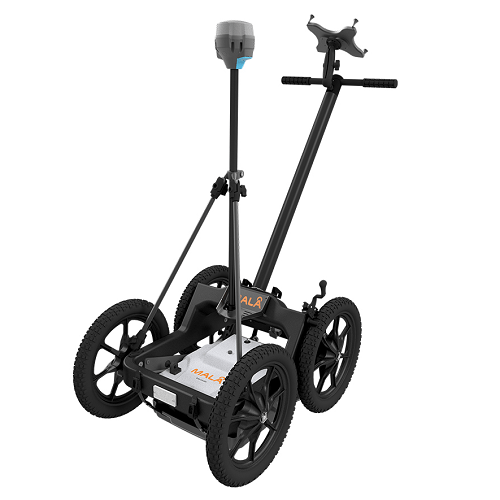
MALA Easy Locator Core
MALA Easy Locator Core – a portable GPR with advanced AI capabilities for high-accuracy underground utility detection. Easy to carry, precise, and efficient for any fieldwork
View details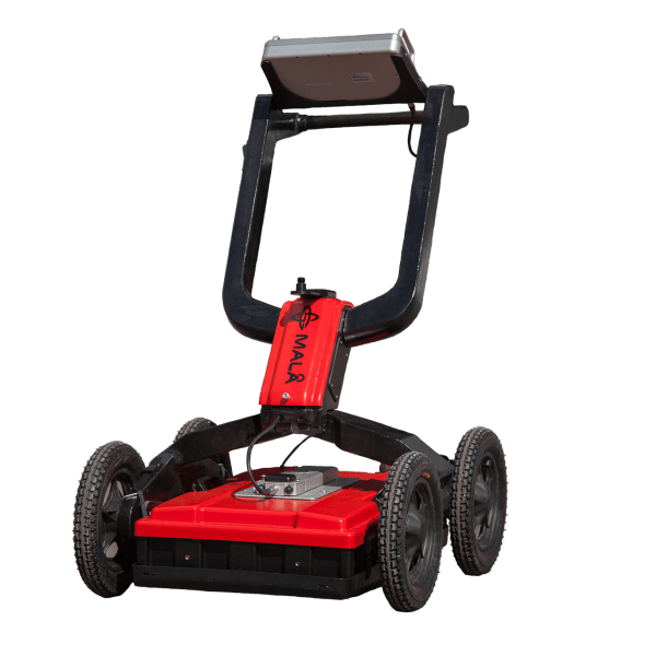
MALA Easy Locator HDR WideRange
MALA Easy Locator HDR WideRange, widest GPR antenna bandwidth available. Specially developed for efficient utility detection.
View details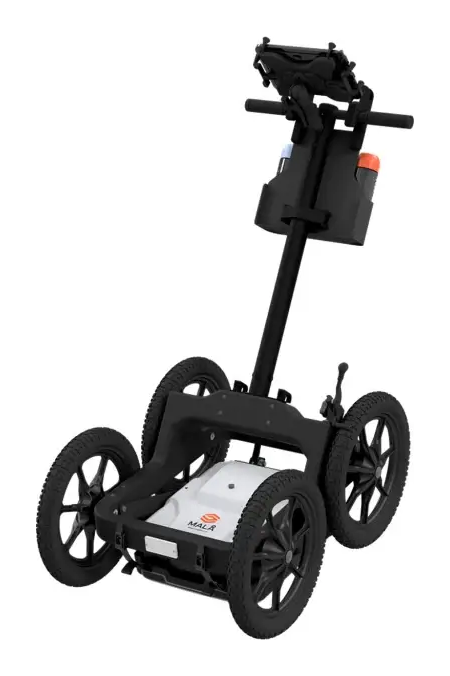
MALA Easy Locator Lite
MALA Easy Locator Lite – an easy-to-use, more affordable GPR for fast utility avoidance and mark-out. Preset for utility locating, with real-time MALÅ AI target support.
View details
MALÅ GeoDrone 80
MALÅ GeoDrone 80 is the cutting-edge solution for unmanned surveying in areas that are dangerous or are hard to reach.
View details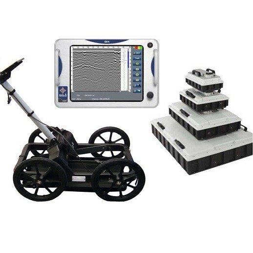
MALÅ Ground Explorer (GX)
Ground Explorer (GX) is an integrated GPR solution with a wide range of antenna options and measuring devices for multiple application.
View details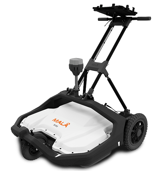
MALA MIRA COMPACT
Discover the MALA Mira Compact GPR for 3D underground utility mapping, sinkhole detection, and void identification. Ideal for infrastructure safety and utility mapping
View details
MALA MIRA HDR 3D GPR
MALÅ redesigned MIRA HDR 3D GPR technology, giving you the best possible data quality, resolution and depth range.
View details
MALÅ Professional Explorer (ProEx)
MALÅ ProEx GPR offers a flexible and versatile approach to detecting subsurface targets and geological layers
View detailsQuestions, Answered
What can GPR detect that an electromagnetic locator cannot?+
GPR can map non-conductive targets — plastic pipes, voids, sinkholes, rebar and layer interfaces — that electromagnetic locators cannot detect.
Do you offer GPR data processing software and training?+
Yes, including MALA Vision software and dedicated data-processing workshops.
Put MALÅ GPR To Work On Your Site.
Tell us about your survey and our specialists will match the right MALÅ system and arrange a demo, quote or training.