Airborne GPR For Hard-To-Reach Areas
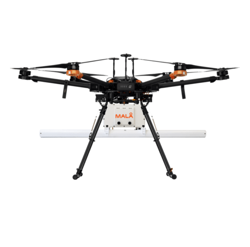
MALÅ GeoDrone 80
A drone-based 80 MHz GPR solution for efficient surveying over land, ice and water where walking, boating or vehicle access is dangerous, slow or impossible.
Choose GeoDrone 80 whenYou need deeper reach for bathymetry, bedrock, larger cavities, larger objects, or deeper ice and snow measurements.
LandIceWaterRemote sites
Fast Decision Guide
GeoDrone 80 Is The Deeper-Reach Option.
The GeoDrone family has two antenna choices. The 80 MHz version is tuned for larger or deeper subsurface targets. The 600 MHz version is better when the survey is shallower and needs finer near-surface resolution.
80 MHz
GeoDrone 80
Deeper investigations, bathymetry, bedrock, larger objects, larger sinkholes and deeper ice or snow.
600 MHz
GeoDrone 600
Smaller near-surface targets, shallow river or lake profiling, shallow bedrock and higher-resolution shallow mapping.
Best Applications
Useful Where Access Is The Problem.
GeoDrone 80 is built for open, remote and hazardous environments: snow-covered ground, uneven terrain, rivers, lakes, avalanche-prone regions and areas where personnel should spend less time on the ground.
Bathymetry Profiling
Profile river, lake, dam and shallow water bottoms from the air when boat access is slow or unsafe.
Bedrock And Geology
Map deeper geological layers, peat thickness, sedimentary structures and depth to bedrock across open areas.
Ice And Snow Surveys
Survey deeper ice and snow where crevasses, slopes, flooding or difficult terrain make walking surveys risky.
Large Targets And Cavities
Look for larger buried objects, sinkholes and cavities greater than 1 m where reach matters more than fine shallow detail.
Field Workflow
Survey From The Air, Then Process In MALÅ Vision.
The system is suitable for automated drone surveying. In the field, operators monitor acquisition through the Controller App. After the flight, MALÅ Vision Web or Desktop is used for visualization, handling and reporting.
Plan The Flight Area
Confirm local permissions for airborne GPR, match the drone lift capacity, and define automated lines for the survey zone.
Monitor In Real Time
Collect data using MALÅ HDR GPR technology with wireless real-time monitoring through the MALÅ Controller App workflow.
Process And Report
Manage, visualize and report the GPR data using MALÅ Vision Web or MALÅ Vision Desktop after the flight.
Specifications
Compare GeoDrone 80 And 600.
Switch between the two airborne GPR models to check drone payload, runtime, positioning and procurement fit before requesting a configuration.
Airborne GPR may require location-specific permissions and regulatory checks. Confirm the rules for the country and site before operating.
| Brand | MALÅ / Guideline Geo |
| System type | Airborne Ground Penetrating Radar (GPR / WPR) |
| Antenna frequency | 80 MHz |
| Core technology | MALÅ HDR GPR |
| Dimensions excl. drone | W580 x L1040 x H240 mm |
| Antenna separation | 530 mm |
| Weight incl. 2 batteries | 3.72 kg |
| Weight excl. 2 batteries | 2.82 kg |
| Drone lift requirement | >3.7 kg / 8.15 lb |
| Operating time | 3+ hours at full battery capacity |
| Time window | 3100 ns |
| Positioning | Built-in GNSS (SBAS), PPS sync |
| Acquisition mode | Time or MALÅ Motion Trig using internal GPS |
| Software | MALÅ Controller App, MALÅ Vision Web and MALÅ Vision Desktop |
Resources
Downloads And Reference Documents.
MALÅ GeoDrone Family BrochureRange overview and 80 vs 600 application guidance.DownloadMALÅ GeoDrone 80 Quick GuideFast field reference for setting up and flying the GeoDrone 80.DownloadMALÅ GeoDrone 80 Technical SpecificationDimensions, weight, frequency, positioning and acquisition details.DownloadMALÅ GeoDrone 600 Quick GuideFast field reference for setting up and flying the GeoDrone 600.DownloadMALÅ GeoDrone 600 User GuideFull operator manual for the 600 MHz airborne GPR.DownloadMALÅ GeoDrone 600 Technical SpecificationDimensions, weight, power, positioning and software details.Download
Recommended Kit
Accessories & Software For GeoDrone
Support GeoDrone airborne surveys with the batteries, controller app and MALÅ Vision software that complete the workflow.

MALA
Li-ion Battery Pack 12 V
Li-Ion battery pack 12V suitable for MALA GPR system.
View accessory
MALA
MALÅ Controller App
MALÅ Controller App makes measurements easier, faster and more cost-efficient. Integrated positioning with Bluetooth.
View accessory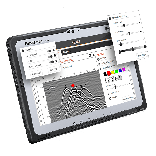
MALA
MALA Vision Software
An easy to use cloud-based GPR analysis software to help you go as fast as possible from data collection to delivering results.
View accessoryMALÅ Range
View GPR rangeCompare With Other GPR Systems
MALA
MALA Easy Locator HDR WideRange
MALA Easy Locator HDR WideRange, widest GPR antenna bandwidth available. Specially developed for efficient utility detection.
View details
MALA
MALA Easy Locator Core
MALA Easy Locator Core – a portable GPR with advanced AI capabilities for high-accuracy underground utility detection. Easy to carry, precise, and efficient for any fieldwork
View details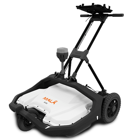
MALA
MALA MIRA COMPACT
Discover the MALA Mira Compact GPR for 3D underground utility mapping, sinkhole detection, and void identification. Ideal for infrastructure safety and utility mapping
View details
MALA
MALA MIRA HDR 3D GPR
MALÅ redesigned MIRA HDR 3D GPR technology, giving you the best possible data quality, resolution and depth range.
View details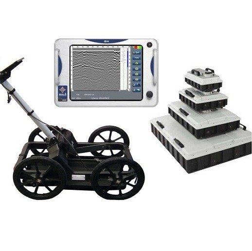
MALÅ
MALÅ Ground Explorer (GX)
Ground Explorer (GX) is an integrated GPR solution with a wide range of antenna options and measuring devices for multiple application.
View details
MALA
MALÅ Professional Explorer (ProEx)
MALÅ ProEx GPR offers a flexible and versatile approach to detecting subsurface targets and geological layers
View detailsConfigure GeoDrone 80
Check The Drone, Site And Survey Depth Before You Buy.
RD-Palmer can help match GeoDrone 80 to your target depth, survey environment, positioning workflow, software needs, training and local support requirements.