MALA Easy Locator Core
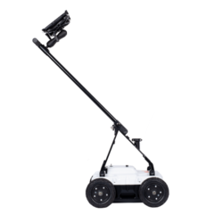
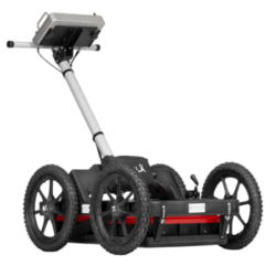
MALA Easy Locator Core GPR Kit
Standard Package Included
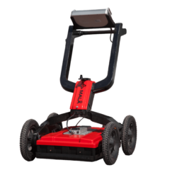
- Easy Locator Core
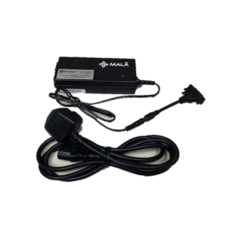
- Dual Li-Ion Battery Charger
- MALA Vision Premium – 3 months (Prepaid)
ADD ON:
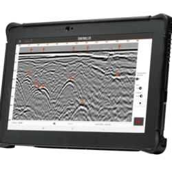
+ Rugged Android Tablet with MALA Controller App
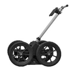
+ RTC Mini cart for EL Core
Product successfully added to the Quote List
MALA Easy Locator Core
Real-time MALÅ AI interpretation support is a revolution in the GPR world.
MALÅ Easy Locator Core is the first product world-wide using intelligent real-time interpretation support for utility locating. All markers set by MALÅ AI can be converted to standard markers with localized utility color codes directly in the field. This provide an invaluable interpretation support for inexperienced users, but also speeds up the interpretation process for more experienced users, thus saving valuable time.
When point objects have been identified and marked with the real-time MALÅ AI interpretation support tool the markers can be converted into regular object markers and exported to MALÅ Vision for further processing.
- Intuitive for beginners – Complete for experts
- Optimized for locating and mapping utilities
- Swedish quality, unparalleled performance and a variety of revolutionary new features
- Lighter and easier to use than anything else
- Rugged and capable of traversing the toughest terrain
- Unsurpassed resolution, bandwidth, and data clarity
- Real-time interpretation from MALÅ AI while collecting data
- Access and share your data anywhere on any device
- Cloud-connected to MALÅ Vision for instant processing in the field
- Constantly updated with new unique features and improvements
- Built with the pride and the passion of a company with a century as leaders in geophysics
- All with the fastest workflow on the market
MALÅ Controller App
GPR Data Acquisitioning on your mobile device
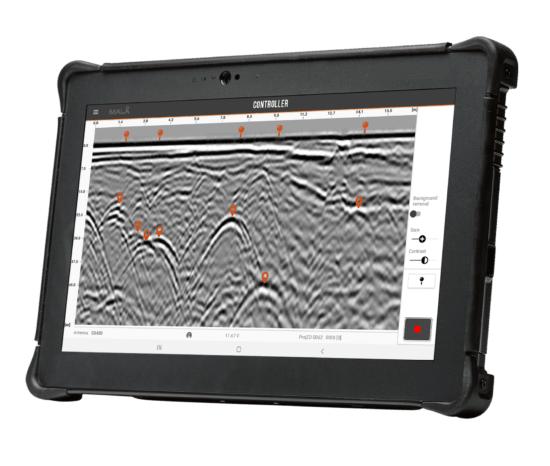
MALÅ Controller App is an easy-to-use acquisition software to help you go as fast as possible from data collection to delivering results. The intuitive user interface lets you view and interpret while data is being collected. Set gain and contrast, remove background noise and set object and surface markers. The touch-based interface speeds up your survey, letting you deliver results quicker.
MALÅ Vision
Visualize and present GPR data in 2D and 3D
MALÅ Vision is easy-to-use GPR processing software for handling of GPR data, developed for usage on any device for all types of GPR users. MALÅ Vision includes MALÅ AI for automated interpretation support and creation of polylines.The built in MALÅ AI of the MALÅ Vision cloud-based post processing software will provide further support by analyzing the markers and pointing to the location of possible pipes and cables in your data set. Document all buried assets. View your results on Google maps or OpenLayers, use satellite images or Street view (first person view) of your site. Export your results as printed maps, dxf or kmz for easy sharing.
Rough Terrain Cart
Traverse any terrain
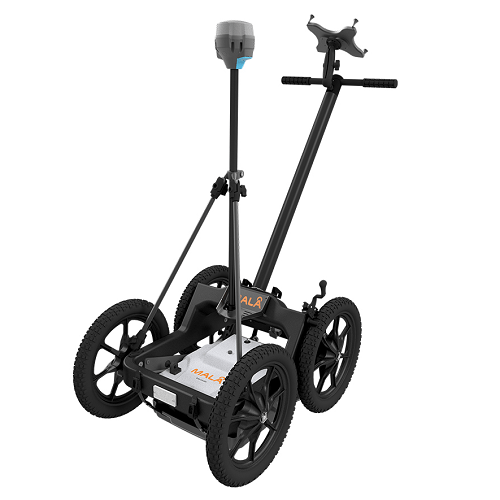
The Easy Locator Core works on any surface and in any terrain. In its basic configuration it is ideal for confined spaces and flat surfaces. With MALÅ RTC Mini cart it provide the solution for rough terrain surveying.
Introduction to MALA Easy Locator
| MALA EL Core Options | EL Core Standard, EL Core Tab, EL Core Mini Cart |
|---|
Application
For Avoidance
Avoidance is mainly done on the fly by the same team performing the on-site excavation. The MALÅ Easy Locator Core is great for avoidance with it’s light and flexible design, ease-of-use and unique ability to support the user with instant feedback from MALÅ AI.
For Mark-out
Mark-out is carried out by professional locators such as surveyors or engineers ahead of excavations to pinpoint and mark utilities. The Easy Locator Core has a number of unique strengths which make it the best choice for any mark-out project.
For 3D mapping
Mapping involves post-processing and interpretation of data, producing a map of all utilities in an area. Permanently recording the results. The cloud-connected Easy Locator Core offers unlimited mapping of utilities in a number of different ways such as with our powerful Dynamic grid or fully unrestricted using RTK GPS or a Total Station.
Features
Optimized for locating and mapping utilities
Lighter and easier to use than anything else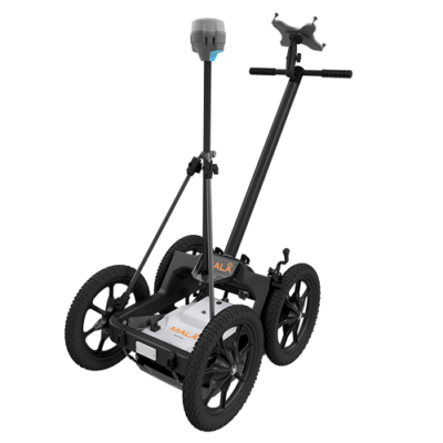
The Locating industry demands high quality, ruggedized and precise GPR equipment. Field equipment needs to be easy to transport, quick to setup and use and with right functionality to efficiently getting the job done.
The MALÅ Easy Locator Core is the new market leader in GPR utility locating and mapping. Its functional design and ease of use are desired by utility locators world-wide.
It’s lighter and easier to use than anything else but also extremely rugged and capable of traversing the toughest terrain when combined with the recommended RTC Mini option.
MALÅ AI
Real time MALÅ AI interpretation support
Real-time MALÅ AI interpretation support is a revolution in the GPR world. MALÅ Easy Locator Core is the first product world-wide using intelligent real-time interpretation support for utility locating. All markers set by MALÅ AI can be converted to standard markers with localized utility color codes directly in the field.
This provide an invaluable interpretation support for inexperienced users, but also speeds up the interpretation process for more experienced users, thus saving valuable time. When point objects have been identified and marked with the real-time MALÅ AI interpretation support tool the markers can be converted into regular object markers and exported to MALÅ Vision for further processing.
MALÅ Controller App
Acquisition software for the Easy Locator Core
MALÅ Controller App is an easy-to-use acquisition software optimized for Utility Locating with the Easy Locator Core. It also support other App-Enabled products from MALÅ. It helps you to go as fast as possible from data collection to delivering results.
The intuitive user interface lets you view and interpret while data is being collected. All with real-time interpretation support from MALÅ AI. Set gain and contrast, remove background noise and set object and surface markers. The touch-based interface speeds up your survey, letting you deliver results quicker.
MALÅ Vision
Processing software for the Easy Locator Core
MALÅ Vision is easy-to-use GPR processing software for handling of GPR data, developed for usage on any device for all types of GPR users. MALÅ Vision includes MALÅ AI for automated interpretation support and other powerful features such as automated polylines.

The built in MALÅ AI of the MALÅ Vision cloud-based post processing software will provide further support by analyzing the markers and pointing to the location of possible pipes and cables in your data set. Document all buried assets.
View your results on Google maps or OpenLayers, use satellite images or Street view (first person view) of your site. Export your results as printed maps, dxf or kmz for easy sharing.
Download
Only logged in customers who have purchased this product may leave a review.
Related products
Borehole Antennas
EASY LOCATOR SERIES







Reviews
There are no reviews yet.